The Livingstons
Every ten years, from 1841, a census was undertaken across the UK which gives a snapshot of everyone living within the country on a specific day. To record townships such as Auchindrain the records were taken walking from one end to the other, and as we’ve got the MacCallums with us from 1841 right up until the 1960s, our census records start or end with them. However, the 1851 census is an exception, where we start with a family of Livingstons before the McCallums. This mysterious family are only with us for this one census, and are made up of Hugh Livingston, a labourer, and his wife Mary, both of whom are 38. They’re living with their four daughters, aged between 13 and 7 months.
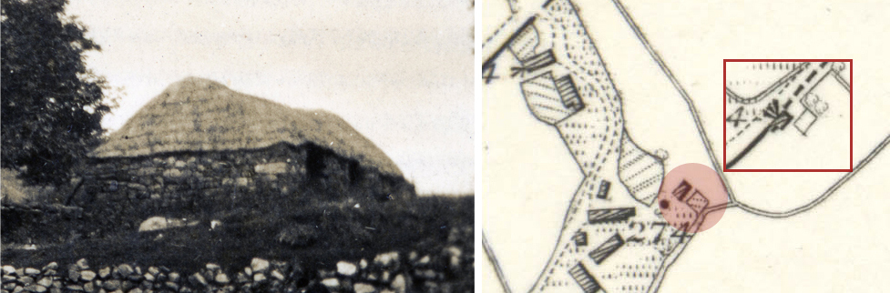
From the 1871 map, it would appear that the Livingstons were living at the very eastern boundary of Auchindrain, within what is now an area of forestry. The map shows a small rectangle with black shading, which is a roofed structure, as well as an empty rectangle which would be their kaleyard. Today there’s a hint of these structures indicated by a large pile of stones and slight differences in the vegetation growing, but it’s barely visible from the road. The house and kaleyard look like they’re a similar size to our Building G, and probably would have been stone with a thatched roof. By the next OS map, in 1897, this building is shown without a roof and no one has lived in that area since.